
TRAILS
Greenbelt Walkway
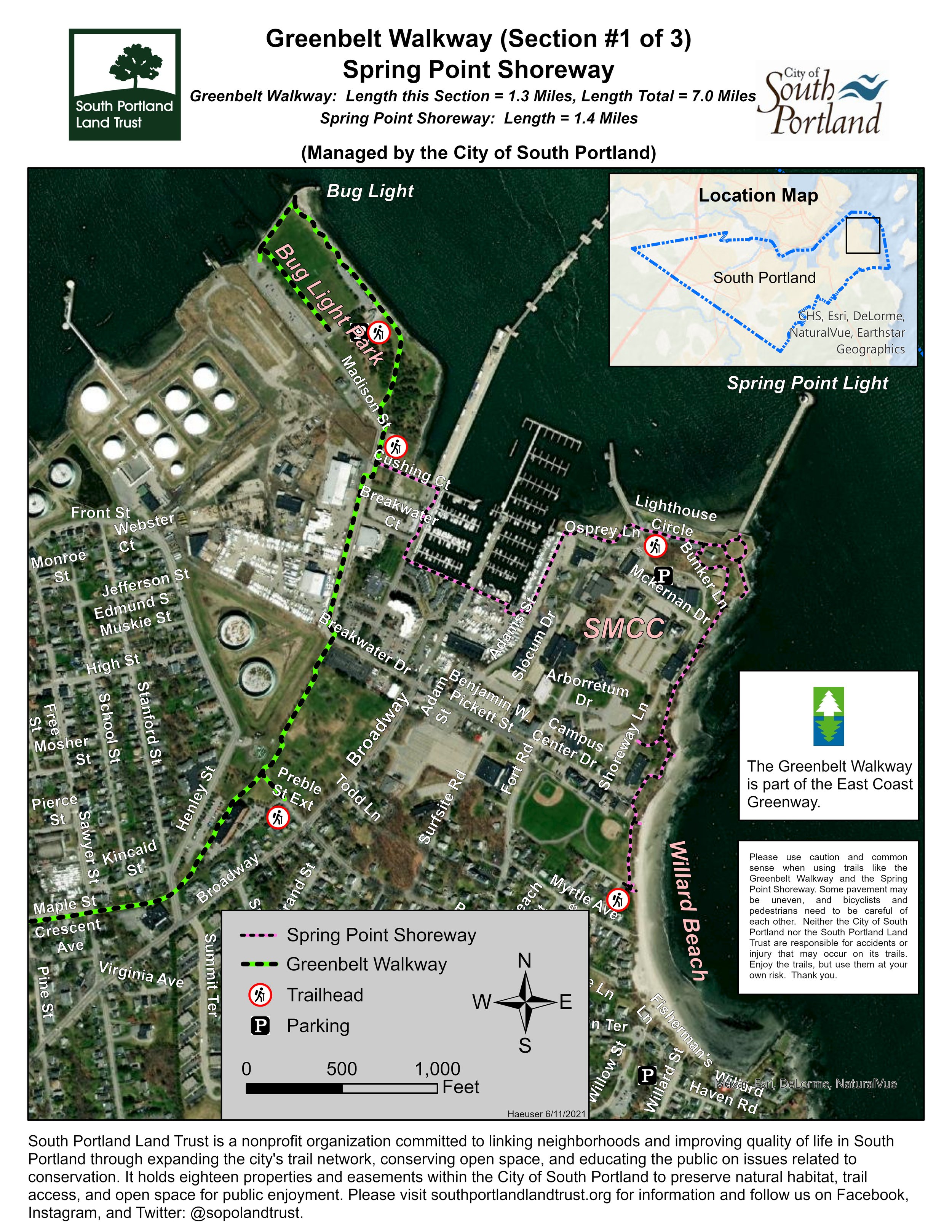
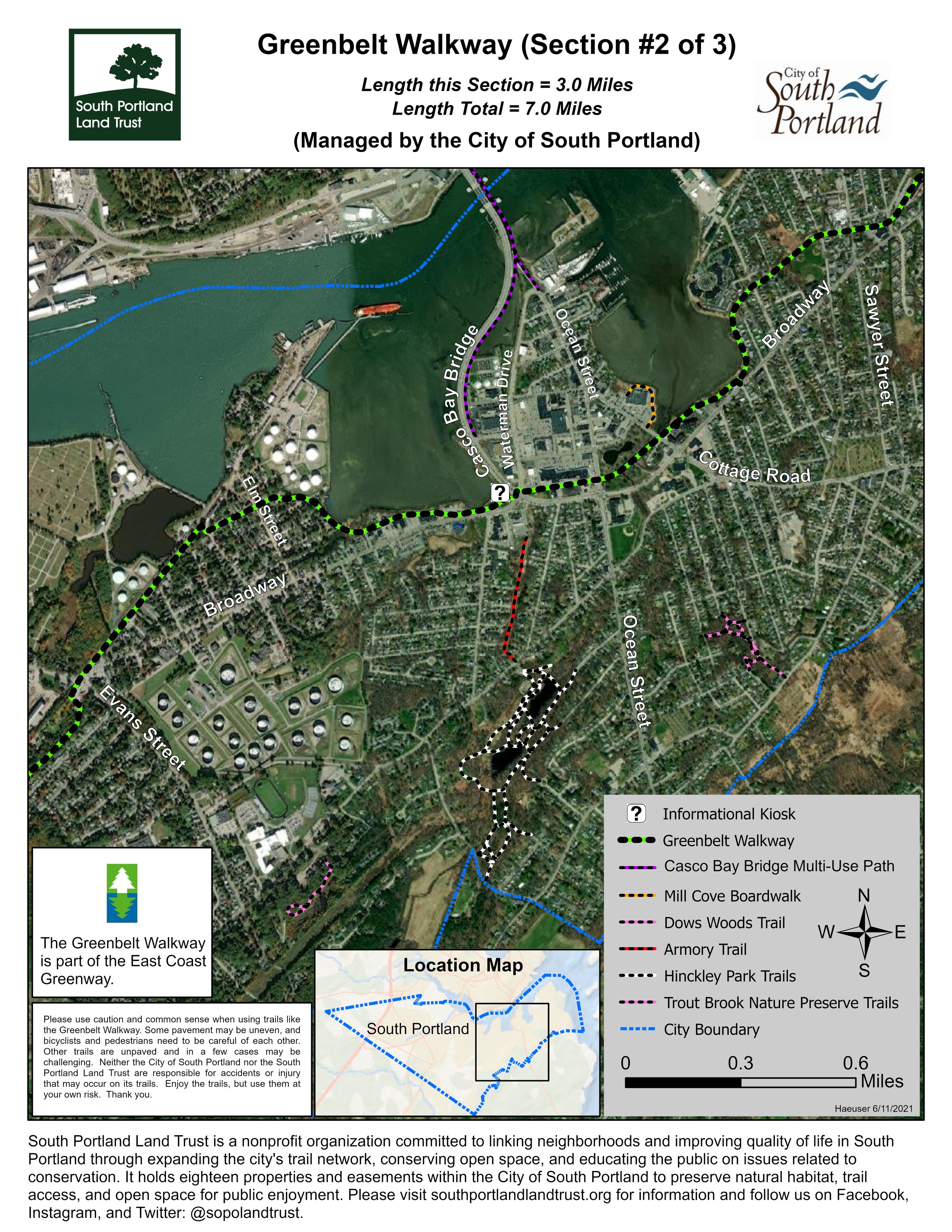
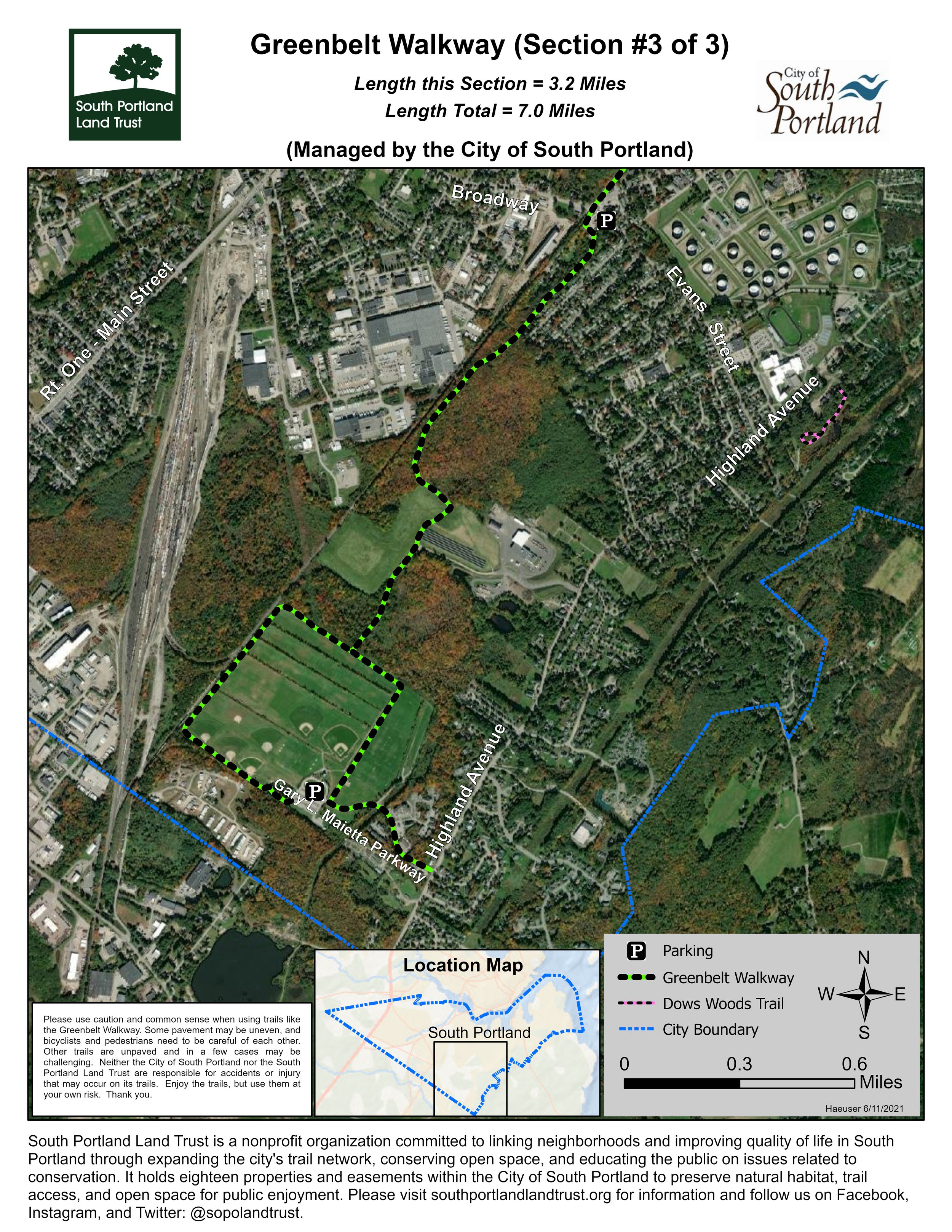
From south to north, the trail spans 5.6 miles, from the Wainwright Athletic complex near the Scarborough town line to Bug Light Park.
Managed by the City of South Portland


Click the thumbnails above to change the map to show Sections 1-3.
Trail Heads
The GREENBELT WALKWAY has three primary access points:
Wainwright Athletic Fields: Winwright Fields: Follow Highland Avenue south 2.6 miles from ME Route 77 in South Portland, and look for Gary Maietta Drive on the right. From Scarbrough, follow Highland Avenue 2.8 miles north from its intersection with ME Route 207. Follow Gary Maietta Drive until it ends at the Wainwright Athletic Fields' parking lot.
Bug Light Park: Follow Broadway to its northern end in South Portland. Turn left onto Breakwater Drive and then left onto Madison Street. Follow Madison Street into Bug Light.
Mill Creek Park: Mill Creek Park is at the intersection of Broadway and Ocean Street in South Portland just east of the Casco Bay Bridge. Parking is on the street around the park.
About the Trail
The Greenbelt Walkway was built in phases beginning in the 1970s and is enjoyed by thousands of residents as well as the many visitors to Greater Portland each year. The trail extends nearly 6 miles from historic Bug Light Park (where Liberty Ships were built during WWII) to the Wainwright Recreation Complex toward the west end of the city.
The trail treats walkers, runners and cyclists to three notable waterfront vistas as it winds through the neighborhoods of Ferry Village, Knightville, Pleasantdale and Broadview Park. The Greenbelt Walkway is part of the Eastern Trail, a walking and cycling trail that will lead from South Portland to Kittery, Maine, which in turn is part of the East Coast Greenway, a trail that will someday span over 3,000 miles from Calais, Maine to Key West Florida.
Photo Gallery
Click on a photo to open it in a larger window.


